
Two Rivers Wisconsin 1979 Original Vintage USGS Topo Map
$34.95

Two Rivers Quadrangle Wisconsin- 7.5 Minute Series Published by the United States Geological Survey Year Published: 1979 Edition Year: 1978 Places: Two Rivers Water Bodies: East Twin River, Lake Michigan, West Twin River
Map may have red institutional rubber stamp and/or writing in the margin - please see the photograph. The map in the photo is the actual map you will receive. Map sheet measures approximately 22 X 27 inches.
All maps we sell are original USGS topographic maps, printed in the year stated in the title. We do not sell reproductions. Maps are shipped rolled up in a sturdy tube.
[14393]
When you click on links to various merchants on this site and make a purchase, this can result in this site earning a commission. Affiliate programs and affiliations include, but are not limited to, the eBay Partner Network.

 Vintage real photo postcard Rare advertising order form Two Rivers Wisconsin$19.50
 TWO RIVERS, Wisconsin Postcard "Public School" Building View / - Dated 1915$7.99
 Two Rivers Wisconsin 1979 Original Vintage USGS Topo Map$34.95
 1898 Admiral George Dewey Victory Manila Bay Aluminum Two Rivers, Wisconsin$117.50
 Vintage Two Rivers Bock Beer Label Two Rivers, Wisconsin$3.99
 Two Rivers, Wisconsin WI St. Luke's School with Church, Parsonage Sisters Home$7.99
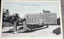 Two Rivers WI Two Rivers Hospital Vintage Postcard Wisconsin$3.99
 Two Rivers, Wisconsin WI Greetings from Teich Large Letter Original Vintage$5.99
 www.userbars.org












