
Spatial Data Science : With Applications in R, Hardcover by Pebesma, Edzer; B...
$124.37

Spatial Data Science : With Applications in R, Hardcover by Pebesma, Edzer; Bivand, Roger, ISBN 1138311189, ISBN-13 9781138311183, Like New Used, Free shipping in the US\"Spatial Data Science introduces fundamental aspects of spatial data that every data scientist should know before they start working with spatial data. These aspects include how geometries are represented, coordinate reference systems (projections, datums), the fact that the Earth is round and its consequences for analysis, and how attributes of geometries can relate to geometries. In the second part of th, these concepts are illustrated with data science examples using the R language. In the thirdpart, statistical modelling approaches are demonstrated using real world data examples. After reading this book, a number of major spatial data analysis errors should no longer be made because of lack of knowledge. Th gives a detailed explanation of the core spatial software packages for R: sf for simple feature access, and stars for raster and vector data cubes - array data with spatial and temporal dimensions. It also shows how geometrical operations change when going from a flat space to the surface of a sphere, which is what sf and stars use when coordinates are not projected (degrees longitude/latitude). Separate chapters detail a variety of plotting approaches for spatial maps using R, and different ways of handling very large vector or raster (imagery) datasets, locally, in databases, or in the cloud\"--
When you click on links to various merchants on this site and make a purchase, this can result in this site earning a commission. Affiliate programs and affiliations include, but are not limited to, the eBay Partner Network.

 Geographical Data Science and Spatial Data Analysis: An Introduction in R (Spat$36.83
 Geographical Data Science & Spatial Data by Lex Comber (Paperback Book)$41.08
 Spatial Data Science by Dr. John P. Wilson$48.99
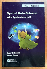 Spatial Data Science: With Applications in R by Pebesma & Bivand - Brand New$95.00
 ✅NEW Spatial Data Science Conference NY 2024Canvas Swag Tote Shopping Books Bag.$12.00
 ✅NEW Spatial Data Science Conference NY Canvas Swag Tote Shopping Books Bag.$15.00
 ✅New Spatial Data Science Conference NYC Canvas Tote Bag.$15.00
 Spatial Data Science : With Applications in R, Hardcover by Pebesma, Edzer; B...$124.37
 www.userbars.org












